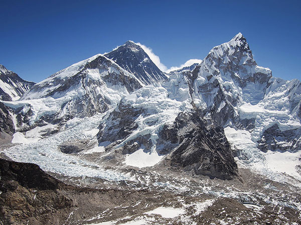
Researchers surveying ice loss from 650 glaciers across a 2000-kilometer (1240-mile) west-to-east expanse of the Himalayan Mountains reported in the journal Science Advances (June 2019) significant melting caused by global climate change over the past 40 years. For the hundreds of individuals who attempt to climb Mount Everest each year, this is unfortunate news because the ascent will become more hazardous as cracks in the ice become deeper and icefalls and rockfalls occur more frequently. However, for the roughly one billion people in Asia whose water source is meltwater from the Himalayas, this is potentially catastrophic news should their water supply ultimately dry up. In addition, local residents face more immediate dangers from landslides and flooding from bursting dams of high-altitude lakes, as melting accelerates. See also: Asia; Glacial geology and landforms; Glaciology; Global climate change; Landslide; Mountain systems

To assess the extent of glacier melting, researchers compared repeat coverage from satellite images taken over time by using a digital elevation model to provide a three-dimensional representation of the glaciers' surface. Images from the 1970s and 1980s came from U.S. declassified spy satellite imagery, with the rest of the imagery taken by a NASA satellite. When the analysis was complete, the researchers observed that Himalayan glaciers lost an average of 0.25 meters (10 inches) of ice per year from 1975 to 2000 and an average 0.5 meters (20 inches) of ice per year from 2000 to 2016. This doubling of the average ice loss since 2000 coincided with an average temperature increase of 1 degree Celsius. Given the consistency of ice loss across the area surveyed, no regional effects caused by weather were observed. For the foreseeable and warming future, the ice loss appears to be unstoppable unless some action is taken to cool the planet. See also: Digital elevation models; Hydrological consequences of global warming; Remote sensing


