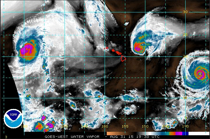
On August 29, 2015, three major hurricanes were active over the Pacific Ocean at the same time—a meteorological first. According to the National Oceanic and Atmospheric Administration’s (NOAA) National Hurricane Center, a major hurricane has wind speeds of 111 mi/h (178 km/h) or higher, which qualifies as a category 3 or stronger storm on the Saffir-Simpson hurricane wind scale. By August 30, the three tropical cyclones—Hurricane Kilo, Hurricane Ignacio, and Hurricane Jimena—had strengthened to category 4 (130–156 mi/h, 209–251 km/h) storms. See also: Cyclone; Hurricane; Pacific Ocean; Satellite meteorology; Tropical meteorology; Wind

For 2015, NOAA forecasted an above-normal season for tropical cyclones in the central Pacific based on the expected strengthening of El Niño. In addition to warmer sea-surface temperatures, El Niño decreases the vertical wind shear over the tropical central Pacific, which supports the development of more and stronger tropical cyclones. So far, these predictions are holding true. See also: El Niño


