Over a period of 14 days, from October 28, 2015 to November 10, 2015, two tropical cyclones formed and traversed the Arabian Sea, taking nearly identical paths and bringing hurricane-strength winds and abundant rainfall to Yemen and its island of Socotra 225 miles (360 km) off the Yemeni coast. See also: Cyclone; Hurricane; Indian Ocean
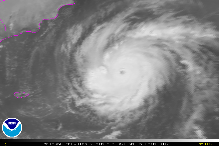
On October 28, 2015, the first storm, Cyclone Chapala, developed in the Arabian Sea west of India. According to the National Aeronautics and Space Administration (NASA), it intensified from a Category 1 storm on the Saffir-Simpson Wind Scale on October 29 to a Category 4 storm on October 30, with maximum sustained winds of 150 mi/h (240 km/h), making it the 23rd Category 4 or 5 storm in the northern hemisphere in 2015 and further surpassing the previous record of 18 storms in 2004. At maximum strength as measure by barometric pressure, Chapala reached a low of 922 millibars (27.23 inches Hg) on October 30, which ranks second to Cyclone Gonu (2007) at 920 mb (27.17 in. Hg) for Arabian Sea storms. See also: Psychrometrics
Cyclone Chapala passed just north of Socotra on November 1, bringing damaging winds and dumping an estimated 16 to 24 inches (400 to 600 millimeters) of rain over the island, which normally receives about 10 inches (250 mm) of rainfall per year. On November 3, 2015 at 4 a.m. UTC (11:00 p.m. EST, Nov. 2), Chapala made landfall on Yemen’s Arabian Sea coast with hurricane-force winds just southwest of Mukalla, causing flooding, structural damage, and complete loss of power to the city. According to the India Meteorological Department, Chapala had maximum sustained winds of 81 mi/h (130 km/h) as it made landfall, which is a Category 1 hurricane. See also: Tropical meteorology; Wind

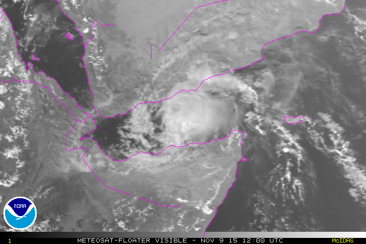
The second storm, Cyclone Megh, became a tropical storm on November 5, 2015. Megh intensified from a Category 1 storm on November 7 to a Category 3 storm on November 8, with maximum sustained winds of 125 mi/h (200 km/h), making it the 28th Category 3 or stronger storm in the northern hemisphere in 2015. Cyclone Megh made landfall directly over Socotra on November 8 at Category 3 strength, according to the India Meteorological Department, causing extensive property damage and flooding. After striking Socotra, the storm began weakening. By the time Megh reached the Yemeni coast on November 10 just northeast of Aden, it was a tropical storm with maximum sustained winds of 40 mi/h (65 km/h).

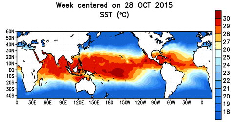
Cyclone Chapala was the first hurricane-strength storm known to make landfall in Yemen. It is very unusual for tropical cyclones to be as strong as Chapala so far south (below 15° N) in the Arabian Sea. However, water temperatures were quite high, although not anomalously so, and wind shear, which can disrupt a tropical cyclone, was low in the region, as it was concurrently throughout the Pacific because of the strong El Niño. Also for the record books, Cyclone Megh was the first Category 3 tropical cyclone in the Arabian Sea during the month of November. It is an extraordinary meteorological record that two cyclones hit Socotra within a one-week timeframe. See also: El Niño


